Hundreds of properties removed from hazard maps


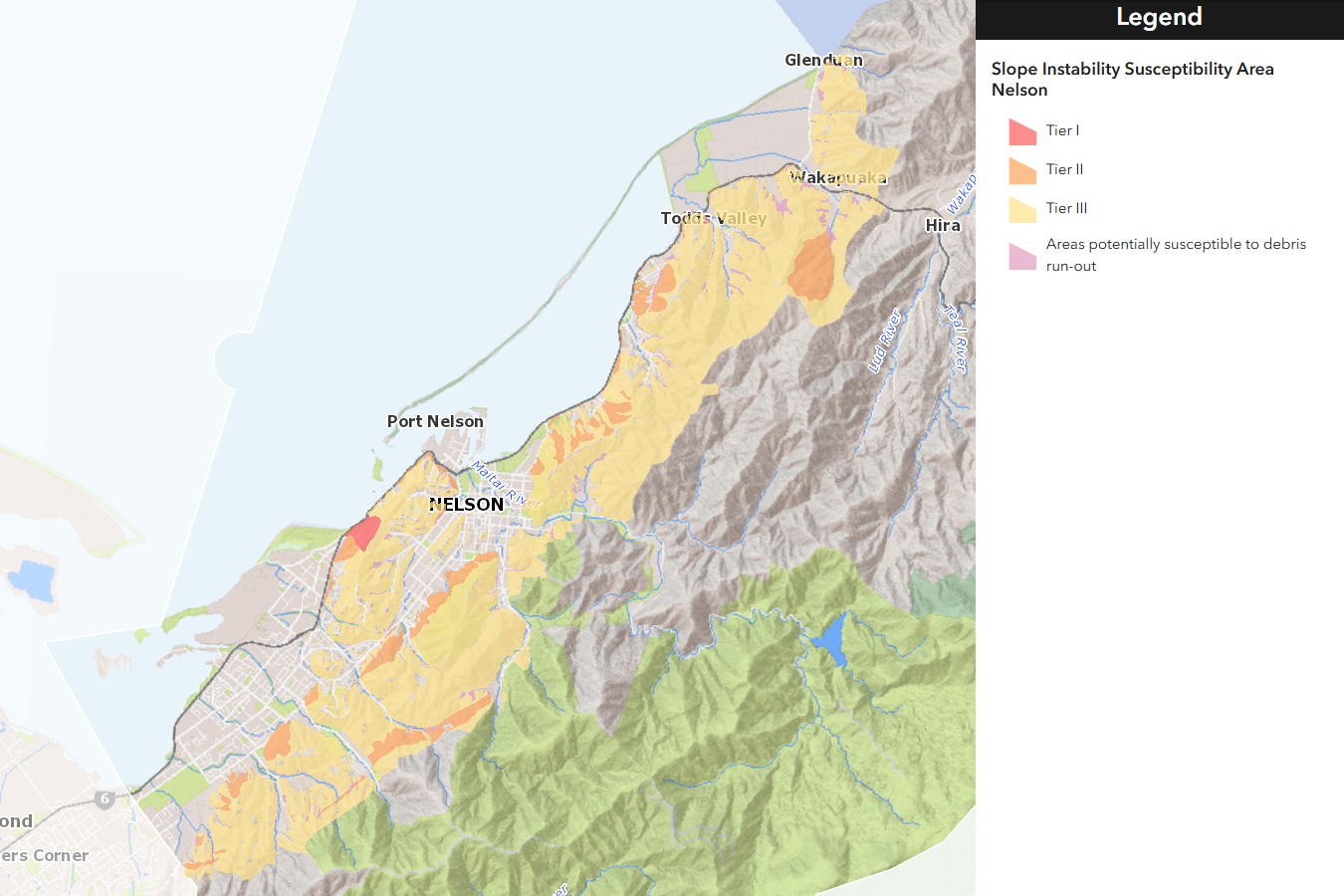
Nelson City Council’s proposed hazard maps have been updated, but some experts believe they’re still not good enough. Photo: Supplied/NCC.
Almost 1100 properties have been removed from Nelson City Council’s slope hazard mapping after an error was discovered.
Some residents and developers previously challenged the accuracy of the maps, but experts representing the council had defended them as “robust”.
The error relates to the “smoothing out” of the slope angle data, rather than the underlying dataset itself which was derived from LiDAR readings from 2008-2015.
The mistake was admitted in a joint witness statement dated 6 November between experts representing the council and a group of developers challenging the council’s hazard maps.
The hazard maps form part of the council’s major overhaul of its planning rules, known as Plan Change 29.
The plan change aims to enable denser housing across the city while managing the risks posed by natural hazards, but the proposal has proven contentious among residents.
The council’s subsequent 27 November geotechnical reply to the independent commissioners overseeing the plan change suggested they adopt the corrected mapping which would see 1098 properties removed from the slope management overlay entirely. No new properties have been added into the overlays because the council doesn’t have the scope to include previously unaffected properties.
The number of properties in the debris run-out overlays has increased by 72 because of the mapping changes, and an additional 42 are affected by both the debris and slope overlays. These properties had already been included in the council’s slope hazard mapping. The area of the Tāhunanui Slump is unchanged.
Two large-scale subdivisions in Bishopdale and the Bayview area are among the properties that have been excluded from the new maps because of large-scale geotechnical engineering which occurred during their development.
Council’s group manager environmental management, Mandy Bishop, says that the work developing and refining the maps and overlays is carried out by technical experts and is peer-reviewed.
“[The revised maps are] now being considered as part of the PC29 process and council has full confidence in the technical analysis provided by experts.”
A group of developers had challenged the council’s hazard mapping through the plan change’s September hearing.
The group’s counsel, resource management lawyer Nigel McFadden, had said at the time that the report underpinning the susceptibility overlays was fundamentally “flawed”.
During the hearing, he urged commissioners to throw the maps out and for the council to “get it done properly”.
But senior geologist Dan Chamberose, representing the council, had replied that the underlying report was “robust” and had gone through a “significant” review process.
Experts representing the developer group believe that additional developed areas, beyond the current two, which have undergone geotechnical engineering should also be removed from the maps.
Their own analysis of the geomorphic methodology used in the slope hazard mapping also identified what they believed to be a wide range of “errors and inconsistencies”.
But in both cases, the council’s experts disagree and say that the maps are now “sufficiently accurate” for their intended purpose.
Should the maps be adopted through the plan change process, it would take another plan change to alter them.
The approach of including the hazard maps in the plan aimed to provide certainty for plan users and property owners.

